Madhyamaheshwar Trek Distance, Route & Map Guide 2026
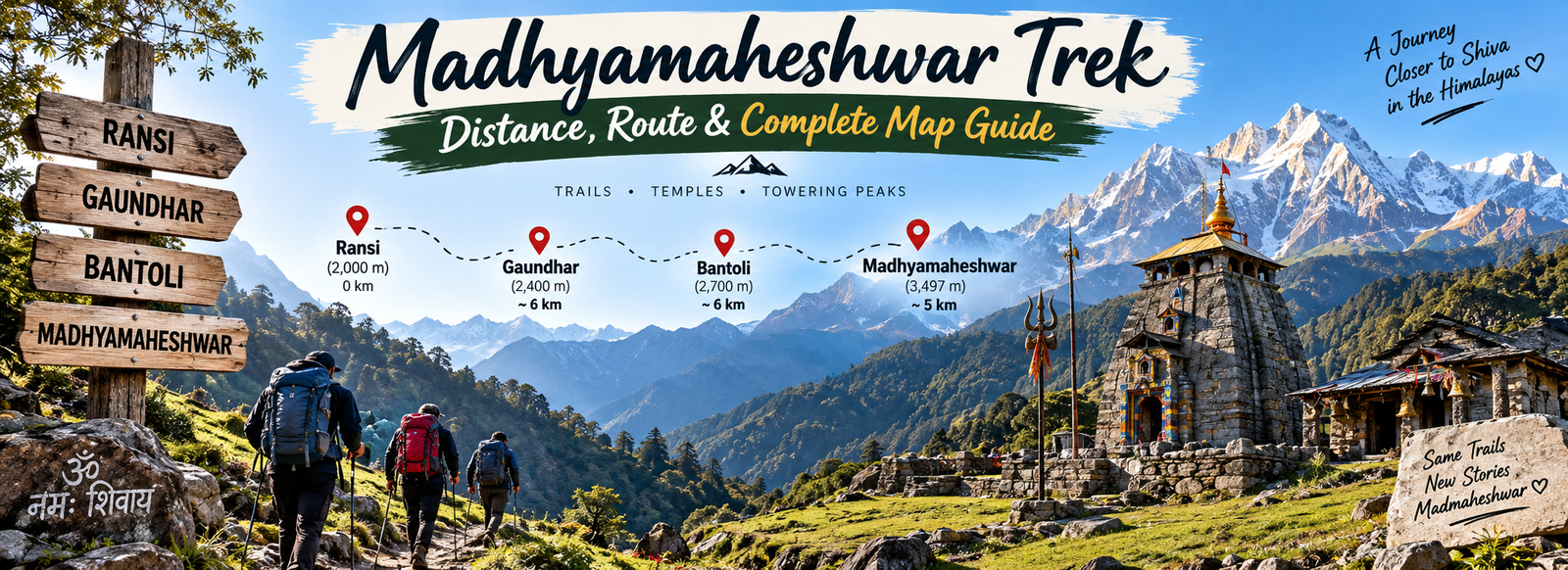
The Madmaheshwar Trek is a Himalayan pilgrimage trail leading to one of the sacred Panch Kedar temples. For anyone planning the journey, the most useful starting point is understanding the difference between the road journey and the actual trek. Vehicles reach Ransi village, and the walking route begins from there. From Ransi, the trek to Madhyamaheshwar Temple is approximately 17 km one way.
A 17 km figure can sound simple on paper, but a Himalayan trail should never be judged by distance alone. Terrain, gradients, altitude, weather, footwear, backpack weight and your walking pace all influence the experience. This guide breaks the route into recognizable stages so you can understand the trail before starting and use the map as a practical planning tool rather than simply looking at a kilometre number.
If you are also comparing the physical challenge of the route, read Madhyamaheshwar Temple Trek guide for additional preparation context.
Quick answer: The Madhyamaheshwar trekking route is roughly 17 km from Ransi to the temple. The trail passes through important route points including Gaundhar and Bantoli before reaching the Madhyamaheshwar temple area. Plan the walk by stages, keep enough daylight available, and allow extra time for breaks and changing mountain conditions.
Madhyamaheshwar Trek Distance at a Glance
| Route Point | Purpose | Planning Focus |
|---|---|---|
| Ransi | Trek starting point | Prepare for the walking section |
| Gaundar | Major trail settlement | Useful stage and rest reference |
| Bantoli | Key route point | Check pace, water and remaining daylight |
| Madhyamaheshwar Temple | Trek destination | Final walking objective |
The approximately 17 km distance is a practical planning figure for the walking route from Ransi to the temple. Your exact GPS track can vary slightly depending on the map source and trail line used.
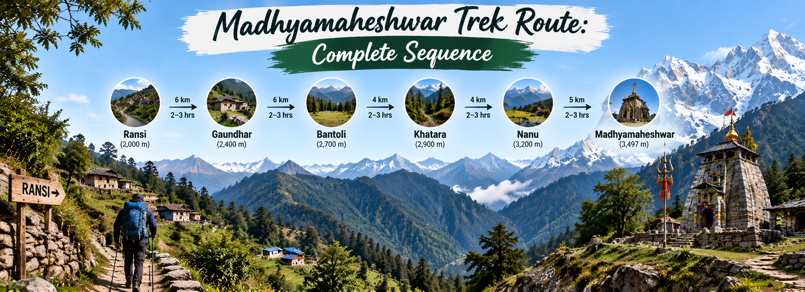
Madhyamaheshwar Trek Route: Complete Sequence
The route becomes much easier to understand when you divide it into four simple stages. Ransi is the roadhead, Gaundhar and Bantoli provide recognizable points along the trail, and the temple is the final destination. These names are useful when discussing your progress with fellow trekkers, local support staff or your guide.
Ransi: Where the Trek Begins
Ransi marks the transition from the motorable approach to the walking trail. Before leaving, adjust your backpack, check your footwear, carry enough water and keep rain protection accessible. A comfortable start is more valuable than trying to gain distance quickly.
Ransi to Gaundar
The trail continues deeper into the mountain landscape towards Gaundar. Use this portion to settle into a steady rhythm. Short, regular breaks can help you maintain energy better than long stops after pushing too hard.
Gaundar to Bantoli
Gaundar and Bantoli work as practical reference points on the route. Instead of constantly watching the kilometre count, use these locations to reassess your pace, hydration, food and available daylight.
Bantoli to Madhyamaheshwar
The trail continues from Bantoli towards the temple area. Keep your pace controlled during the final section, especially if you have already spent several hours walking. Essential items should remain easy to reach inside your daypack.
Understanding the Madhyamaheshwar Trek Map
A useful trek map should answer three questions: where you start, which route points come next, and where the walking route ends. On the Madhyamaheshwar map, mark Ransi first, then follow the established trail through Gaundhar and Bantoli towards the temple. This simple sequence gives you a mental picture of the journey even when you are not checking your phone.
If you use a digital navigation application, select the walking option and download the relevant area for offline use before starting. Road navigation is not the same as trek navigation, and an application may show an unsuitable vehicle route if the travel mode is incorrect. Local guidance and current trail information should always be considered alongside a digital map.
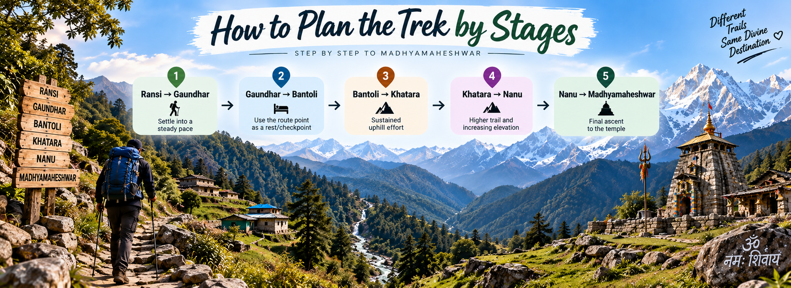
How to Plan the Trek by Stages
There is no single walking time that suits every trekker. Your pace changes with fitness, backpack weight, weather, trail conditions and the length of your breaks. A stage-based plan therefore gives you more useful control than trying to match someone else's exact timing.
Settle Into Your Pace
Use the beginning of the route to establish a sustainable rhythm. Avoid spending too much energy early in the day because the objective is to complete the full route comfortably.
Use Route Points as Checkpoints
Gaundhar and Bantoli can help you understand progress without relying entirely on a phone. Use these points to drink water, have a snack and review the remaining plan.
Protect the Final Section
Keep the final approach unhurried. Watch your footing, stay with your group and keep enough energy to enjoy the temple surroundings after reaching the destination.
What to Carry for the Madhyamaheshwar Route
- ✓Trekking shoes with dependable grip for uneven mountain terrain.
- ✓Light layers, rain protection and an extra warm layer for changing conditions.
- ✓Water, personal medicines, basic first-aid supplies and compact snacks.
- ✓Offline map, charged phone and power bank for navigation and communication.
- ✓A small daypack that keeps frequently used items easy to reach.
Keep the trekking load practical. Heavy luggage can make a mountain trail feel considerably harder, so carry only what you genuinely need for the walking section. Protect documents and electronics from rain and keep water, medicines and weather gear near the top of the bag.
Important Route Planning Tips
- Start from Ransi with enough daylight for the walking stage you have planned.
- Judge the route by terrain and personal pace, not just the kilometre figure.
- Download your walking map before entering areas with uncertain connectivity.
- Keep your itinerary flexible enough for weather and trail-related delays.
- Carry your waste back and respect the Himalayan environment and pilgrimage route.
Planning your Madmaheshwar trek in advance can make the journey much easier. If you are looking for a complete travel plan with stay, transport and trekking arrangements, explore Madmaheshwar Tour Package for a convenient trip.
Frequently Asked Questions
How long is the Madhyamaheshwar trek?+
The walking route from Ransi to Madhyamaheshwar Temple is approximately 17 km one way. Actual GPS distance can vary slightly depending on the map source and trail line.
Where does the Madhyamaheshwar trek start?+
Ransi village is the roadhead and starting point for the walking section of the Madhyamaheshwar route.
Which places come on the Madhyamaheshwar trek route?+
The main route references covered in this guide are Ransi, Gaundhar and Bantoli, followed by the trail towards Madhyamaheshwar Temple.
Is the route suitable for first-time trekkers?+
First-time trekkers can plan the route with suitable preparation, but should be ready for a sustained Himalayan walk, uneven terrain, changing weather and a roughly 17 km one-way trail.
Should I download an offline map?+
Yes. Download the walking map before starting because mobile connectivity may be inconsistent in mountain areas. Keep local route information as an additional reference.